Geolocate

Canova topographic map

Click on the map to display elevation.

About this map

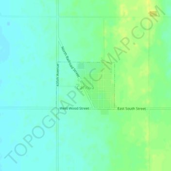
Name: Canova topographic map, elevation, terrain.

Location: Canova, Miner County, South Dakota, United States (43.87749 -97.51051 43.88495 -97.49767)

Average elevation: 1,526 ft

Minimum elevation: 1,499 ft

Maximum elevation: 1,562 ft

Miner County trails, hiking, mountain biking, running and outdoor activities

Gear up for your next adventure:

🛡️Insect Repellent - Protection against bugs during outdoor activities
🔦Powerful Headlamps - Ultra-bright hands-free lighting for night navigation
Backpacking Tents - Weight-optimized shelters for multi-day topographic surveys
🛌Ultralight Sleeping Bags - Compact down bags for cold nights in the wilderness
📱Solar Portable Charger - Solar power bank for charging devices off‑grid

As an Amazon Associate, this site earns from qualifying purchases at no extra cost to you.