Geolocate

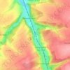
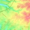
Autigny topographic map

Click on the map to display elevation.

About this map

Name: Autigny topographic map, elevation, terrain.

Location: Autigny, Dieppe, Seine-Maritime, Normandy, Metropolitan France, 76740, France (49.78154 0.83871 49.81051 0.86911)

Average elevation: 308 ft

Minimum elevation: 174 ft

Maximum elevation: 400 ft

Other topographic maps

Click on a map to view its topography, its elevation and its terrain.

Saint-Adrien

France > Normandy > Seine-Maritime > Belbeuf

Average elevation: 184 ft

Puys Beach

France > Normandy > Seine-Maritime > Dieppe > Puys

Average elevation: 98 ft

Le Pollet

France > Normandy > Seine-Maritime > Torcy-le-Petit

Average elevation: 276 ft

Edreville

France > Normandy > Seine-Maritime > Octeville-sur-Mer

Average elevation: 256 ft

La Grand Route

France > Normandy > Seine-Maritime > Écalles-Alix

Average elevation: 482 ft

Le Pière

France > Normandy > Seine-Maritime > Étaimpuis

Average elevation: 515 ft

La Fresnaye

France > Normandy > Seine-Maritime > Buchy

Average elevation: 659 ft

Gear up for your next adventure:

🧥Men's Rain Shells - Premium waterproof and breathable jackets for mountain weather
🪶Thermal Camp Blanket - Extra warmth for cold nights
🎁Geography Themed Gifts - Unique gift ideas for map lovers and geography enthusiasts
📷Action Camera - Capture your outdoor adventures in HD
🥩Freeze-Dried Meals - Nutritious and lightweight food for remote expeditions

As an Amazon Associate, this site earns from qualifying purchases at no extra cost to you.