Geolocate

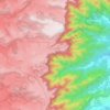
Capinzal topographic map

Click on the map to display elevation.

About this map

Name: Capinzal topographic map, elevation, terrain.

Location: Capinzal, Região Geográfica Imediata de Joaçaba-Herval d'Oeste, Região Geográfica Intermediária de Chapecó, Santa Catarina, South Region, 89665-000, Brazil (-27.51966 -51.73722 -27.32900 -51.53200)

Average elevation: 2,152 ft

Minimum elevation: 1,270 ft

Maximum elevation: 3,025 ft

Other topographic maps

Click on a map to view its topography, its elevation and its terrain.
Três Picos

Brazil > Santa Catarina

Average elevation: 2,608 ft

Residência Fuck

Brazil > Santa Catarina > Monte Castelo

Average elevation: 2,772 ft

Córrego do Fuck

Brazil > Santa Catarina > Canoinhas

Average elevation: 2,579 ft

Serra da Bateia

Brazil > Santa Catarina > Guabiruba

Average elevation: 1,112 ft

Alto Pitanga

Brazil > Santa Catarina > Nova Trento

Average elevation: 1,401 ft

Palhocinha

Brazil > Santa Catarina > Trombudo Central

Average elevation: 1,283 ft

Pericó

Brazil > Santa Catarina > São Joaquim

Average elevation: 4,065 ft

Gear up for your next adventure:

🧣Hiking Neck Gaiter - Multi‑use neck protection for outdoor weather
🕶️Glacier Sunglasses - Side shields to protect eyes from high-altitude snow glare
🔭Compact Binoculars - HD vision for scouting terrain and identifying distant landmarks
📱Solar Portable Charger - Solar power bank for charging devices off‑grid
🌧️Backpack Rain Cover - Keep gear dry in wet weather

As an Amazon Associate, this site earns from qualifying purchases at no extra cost to you.