
Thank you for supporting this site ❤️
Make a donation
Make a donation
Gear up for your next adventure:
As an Amazon Associate, this site earns from qualifying purchases at no extra cost to you.
Churumazu topographic map
Click on the map to display elevation.
Thank you for supporting this site ❤️
Make a donation
Make a donation
Gear up for your next adventure:
As an Amazon Associate, this site earns from qualifying purchases at no extra cost to you.
About this map
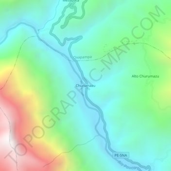
Name: Churumazu topographic map, elevation, terrain.
Location: Churumazu, Villa Rica, Oxapampa, Pasco, Perú (-10.79153 -75.37913 -10.75153 -75.33913)
Average elevation: 4,491 ft
Minimum elevation: 2,867 ft
Maximum elevation: 8,648 ft
Thank you for supporting this site ❤️
Make a donation
Make a donation
Gear up for your next adventure:
As an Amazon Associate, this site earns from qualifying purchases at no extra cost to you.