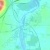
Ballysloe topographic map
Click on the map to display elevation.
About this map

Name: Ballysloe topographic map, elevation, terrain.
Average elevation: 574 ft
Minimum elevation: 413 ft
Maximum elevation: 932 ft
Other topographic maps
Click on a map to view its topography, its elevation and its terrain.


Tipperary
Ireland > County Tipperary > The Municipal District of Cahir — Cashel
Average elevation: 331 ft
Cashel
The Rock of Cashel, to which the town below owes its origin, is an isolated elevation of stratified limestone, rising abruptly from a broad and fertile plain called the Golden Vale. The top of this eminence is crowned by a group of remarkable ruins. Originally known as Fairy Hill, or Sid-Druim, the Rock was,…
Average elevation: 377 ft







Clogheen
Lewis' Topographical Dictionary of 1837 notes Clogheen as being located in the barony of Iffa and Offa West and reported that there were 1,928 inhabitants, a military barracks for the accommodation of two troops of cavalry, an extensive brewery, plus seven flour mills in the town and neighbourhood.
Average elevation: 213 ft