Geolocate

Pianing topographic map

Click on the map to display elevation.

About this map
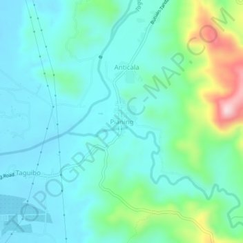
Name: Pianing topographic map, elevation, terrain.

Location: Pianing, Butuan, Caraga, 8600, Philippines (8.96654 125.62159 9.00654 125.66159)

Average elevation: 292 ft

Minimum elevation: 52 ft

Maximum elevation: 1,204 ft

Other topographic maps

Click on a map to view its topography, its elevation and its terrain.

Taguibo Dam

Philippines > Butuan

Average elevation: 823 ft

Taguibo Dam

Philippines > Butuan

Average elevation: 823 ft

Taguibo Dam

Philippines > Butuan

Average elevation: 823 ft

Gear up for your next adventure:

🌲Outdoor Survival Books - Best books on survival skills
🍳Camping Cook Set - Complete cookware for outdoor meals
🪶Survival Guide Book - Expert advice for emergency preparedness
🌡️Portable Weather Meter - Track weather conditions on the trail
🔋Rechargeable Batteries - Power up your outdoor devices

As an Amazon Associate, this site earns from qualifying purchases at no extra cost to you.