Geolocate

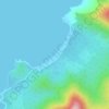
Marayugon topographic map

Click on the map to display elevation.

About this map

Name: Marayugon topographic map, elevation, terrain.

Location: Marayugon, Puerto Princesa, Mimaropa, Philippines (9.95772 118.83471 9.99772 118.87471)

Average elevation: 85 ft

Minimum elevation: -3 ft

Maximum elevation: 466 ft

Other topographic maps

Click on a map to view its topography, its elevation and its terrain.

Malinao River

Philippines > Puerto Princesa > Santa Lucia

Average elevation: 184 ft

Baywalk Park

Philippines > Puerto Princesa

Average elevation: 20 ft

Bacungan River

Philippines > Puerto Princesa

Average elevation: 404 ft

Irawan River

Philippines > Puerto Princesa

Average elevation: 394 ft

Tagkawayan Beach

Philippines > Puerto Princesa

Average elevation: 157 ft

Sabang River

Philippines > Puerto Princesa

Average elevation: 128 ft

Manors Verdant

Philippines > Puerto Princesa

Average elevation: 16 ft

Gear up for your next adventure:

🔥Plasma Lighters - Windproof lighters that work in any weather condition
📖Nature Tracking Books - Learn to track wildlife and terrain
📚Navigation Handbooks - Master the art of reading topographic maps and using a compass
🩹Survival Bandages - High‑quality bandages for emergencies
📱Solar Portable Charger - Solar power bank for charging devices off‑grid

As an Amazon Associate, this site earns from qualifying purchases at no extra cost to you.