
Make a donation
Gear up for your next adventure:
As an Amazon Associate, this site earns from qualifying purchases at no extra cost to you.
Hoge Blekker topographic map
Click on the map to display elevation.
Make a donation
Gear up for your next adventure:
As an Amazon Associate, this site earns from qualifying purchases at no extra cost to you.
Hoge Blekker
Dit zogenaamd rijshout bestond oorspronkelijk uit gekapte duindoorn, later werd vooral snoeihout van de cultuurpopulier gebruikt. De tussenliggende zones werden bepoot met helmgras. Deze grassoort bezit het vermogen om bij overstuiving via verticale uitlopers van zijn wortels boven op het nieuw aangevoerde zand nieuwe planten te ontwikkelen. Door dit proces gingen veel duinen fors aan hoogte winnen.
Make a donation
Gear up for your next adventure:
As an Amazon Associate, this site earns from qualifying purchases at no extra cost to you.
About this map
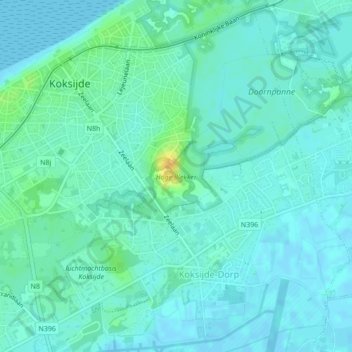
Name: Hoge Blekker topographic map, elevation, terrain.
Average elevation: 20 ft
Minimum elevation: -3 ft
Maximum elevation: 89 ft
Make a donation
Gear up for your next adventure:
As an Amazon Associate, this site earns from qualifying purchases at no extra cost to you.