Geolocate

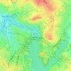
Evatt topographic map

Click on the map to display elevation.

About this map

Name: Evatt topographic map, elevation, terrain.

Location: Evatt, District of Belconnen, Australian Capital Territory, Australia (-35.22267 149.05402 -35.19992 149.08255)

Average elevation: 1,972 ft

Minimum elevation: 1,850 ft

Maximum elevation: 2,313 ft

Other topographic maps

Click on a map to view its topography, its elevation and its terrain.
Diddams Close Park

Australia > District of Belconnen

Average elevation: 1,932 ft

Ginninderra Creek

Australia > District of Belconnen

Average elevation: 1,929 ft

Gossan Hill

Australia > District of Belconnen

Average elevation: 2,041 ft

Mount Rogers

Australia > District of Belconnen

Mount Rogers is a large hill, with an elevation of 704 metres (2,310 ft), located in the northern suburbs of Canberra, within the Australian Capital Territory, Australia. There is a park called the Mount Rogers Reserve at the crest of the hill, and a trig point at the summit.

Average elevation: 2,034 ft

Gear up for your next adventure:

🧭Orienteering Set - Complete compass and map reading kit
⛑️Personal Locator Beacon - Safety beacon for emergencies
🧦Hiking Socks - Comfortable socks to prevent blisters on long hikes
🧤Hiking Gloves - Protective gloves for rugged trails
⌚GPS Sports Watch - GPS watch for running, hiking and training

As an Amazon Associate, this site earns from qualifying purchases at no extra cost to you.