
Moià topographic map
Interactive map
Click on the map to display elevation.
About this map
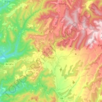
Name: Moià topographic map, elevation, terrain.
Location: Moià, Moianès, Barcelone, Catalogne, 08180, Espagne (41.77514 2.02736 41.86462 2.17241)
Average elevation: 2,411 ft
Minimum elevation: 1,358 ft
Maximum elevation: 3,488 ft
Other topographic maps
Click on a map to view its topography, its elevation and its terrain.