
Thank you for supporting this site ❤️
Make a donation
Make a donation
Gear up for your next adventure:
As an Amazon Associate, this site earns from qualifying purchases at no extra cost to you.
Sabla topographic map
Click on the map to display elevation.
Thank you for supporting this site ❤️
Make a donation
Make a donation
Gear up for your next adventure:
As an Amazon Associate, this site earns from qualifying purchases at no extra cost to you.
About this map
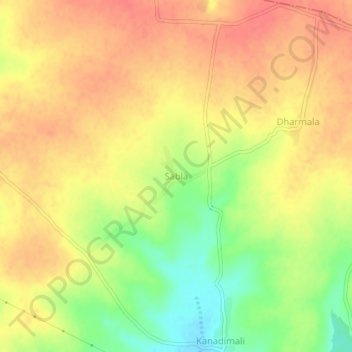
Name: Sabla topographic map, elevation, terrain.
Location: Sabla, Kaij, Beed District, Maharashtra, 431123, India (18.75198 76.03001 18.79198 76.07001)
Average elevation: 2,395 ft
Minimum elevation: 2,277 ft
Maximum elevation: 2,464 ft
Thank you for supporting this site ❤️
Make a donation
Make a donation
Gear up for your next adventure:
As an Amazon Associate, this site earns from qualifying purchases at no extra cost to you.