Geolocate

Onya topographic map

Click on the map to display elevation.

About this map

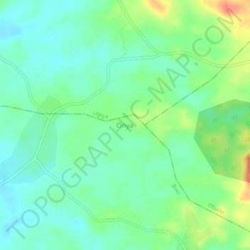
Name: Onya topographic map, elevation, terrain.

Location: Onya, Boki, Cross River State, Nigeria (6.46784 8.90970 6.50784 8.94970)

Average elevation: 397 ft

Minimum elevation: 331 ft

Maximum elevation: 535 ft

Gear up for your next adventure:

📱Solar Portable Charger - Solar power bank for charging devices off‑grid
🧢Sun Protection Hats - Wide-brimmed and UPF-rated hats for high-altitude sun safety
🪶Survival Guide Book - Expert advice for emergency preparedness
📱Heavy-Duty Phone Cases - Drop-proof and waterproof protection for outdoor navigation
🌡️Handheld Weather Meters - Measure wind, temp, and pressure for safe mountain travel

As an Amazon Associate, this site earns from qualifying purchases at no extra cost to you.