Geolocate

Hengelo topographic map

Click on the map to display elevation.

About this map

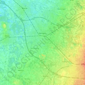
Name: Hengelo topographic map, elevation, terrain.

Location: Hengelo, Overijssel, Netherlands (52.19106 6.70204 52.31359 6.85253)

Average elevation: 75 ft

Minimum elevation: 36 ft

Maximum elevation: 151 ft

Gear up for your next adventure:

😴Insulated Sleeping Pads - Compact and warm pads for high-elevation camping
🔋Rechargeable Batteries - Power up your outdoor devices
🥄Camping Utensil Set - Lightweight utensils for outdoor meals
🪶Trail Camera - Capture wildlife on your hikes
📶Satellite Messenger - Communication device off‑grid

As an Amazon Associate, this site earns from qualifying purchases at no extra cost to you.