
Thank you for supporting this site ❤️
Make a donation
Make a donation
Gear up for your next adventure:
As an Amazon Associate, this site earns from qualifying purchases at no extra cost to you.
Migwani topographic map
Click on the map to display elevation.
Thank you for supporting this site ❤️
Make a donation
Make a donation
Gear up for your next adventure:
As an Amazon Associate, this site earns from qualifying purchases at no extra cost to you.
About this map
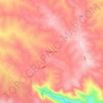
Name: Migwani topographic map, elevation, terrain.
Location: Migwani, Mwingi West, Kitui County, Eastern, Kenya (-1.11224 37.99946 -1.07224 38.03946)
Average elevation: 4,019 ft
Minimum elevation: 3,458 ft
Maximum elevation: 4,177 ft
Thank you for supporting this site ❤️
Make a donation
Make a donation
Gear up for your next adventure:
As an Amazon Associate, this site earns from qualifying purchases at no extra cost to you.