Geolocate

Hampton Butte topographic map

Click on the map to display elevation.

About this map

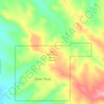
Name: Hampton Butte topographic map, elevation, terrain.

Location: Hampton Butte, Big Horn County, Montana, United States (45.01605 -106.40565 45.01615 -106.40555)

Average elevation: 3,835 ft

Minimum elevation: 3,638 ft

Maximum elevation: 4,052 ft

Big Horn County trails, hiking, mountain biking, running and outdoor activities

Other topographic maps

Click on a map to view its topography, its elevation and its terrain.

Hardin

United States > Montana > Big Horn County

Average elevation: 2,907 ft

Busby

United States > Montana > Big Horn County > Busby

Average elevation: 3,576 ft

Gear up for your next adventure:

🔋Rechargeable Batteries - Power up your outdoor devices
🧦Hiking Socks - Comfortable socks to prevent blisters on long hikes
🪶Wildlife Field Guides - Learn animal tracking and species ID
🪶Paracord Bracelet - Survival bracelet with built‑in tools
🌡️Handheld Weather Meters - Measure wind, temp, and pressure for safe mountain travel

As an Amazon Associate, this site earns from qualifying purchases at no extra cost to you.