
Springbrook topographic map
Click on the map to display elevation.
About this map
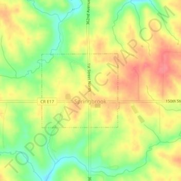
Name: Springbrook topographic map, elevation, terrain.
Location: Springbrook, Jackson County, Iowa, United States (42.16006 -90.48685 42.17109 -90.47122)
Average elevation: 801 ft
Minimum elevation: 676 ft
Maximum elevation: 902 ft
Jackson County trails, hiking, mountain biking, running and outdoor activities
Other topographic maps
Click on a map to view its topography, its elevation and its terrain.
Springbrook
United States > Iowa > Jackson County > Springbrook > Springbrook
Average elevation: 807 ft