
Amawalk topographic map
Click on the map to display elevation.
About this map
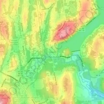
Name: Amawalk topographic map, elevation, terrain.
Average elevation: 486 ft
Minimum elevation: 253 ft
Maximum elevation: 741 ft
Westchester County trails, hiking, mountain biking, running and outdoor activities
Other topographic maps
Click on a map to view its topography, its elevation and its terrain.
Lincolndale
United States > New York > Westchester County > Town of Somers > Lincolndale > Lake Lincolndale
Average elevation: 479 ft
Heritage Hills
United States > New York > Westchester County > Town of Somers > Lincolndale
Average elevation: 466 ft