Geolocate

Warsaw topographic map

Click on the map to display elevation.

About this map

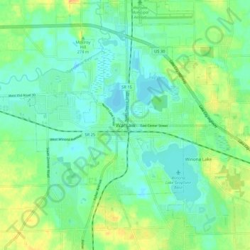
Name: Warsaw topographic map, elevation, terrain.

Location: Warsaw, Kosciusko County, Indiana, 4650, United States (41.19810 -85.89305 41.27810 -85.81305)

Average elevation: 837 ft

Minimum elevation: 797 ft

Maximum elevation: 915 ft

Kosciusko County trails, hiking, mountain biking, running and outdoor activities

Gear up for your next adventure:

📡Handheld GPS Device - Reliable handheld GPS for outdoor navigation
👓Polarized Sunglasses - Outdoor sunglasses for glare reduction
🧣Hiking Neck Gaiter - Multi‑use neck protection for outdoor weather
Solar GPS Watches - Advanced multisport watches with built-in topographic maps
📦Gear Storage Bags - Organize and protect outdoor equipment

As an Amazon Associate, this site earns from qualifying purchases at no extra cost to you.