
Newland topographic map
Click on the map to display elevation.
Newland
At an elevation of 3,621 feet or 1,104 metres, it is the highest county seat in the Eastern United States (based on elevations in the USGS database).
About this map
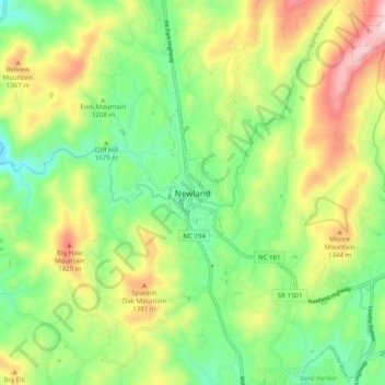
Name: Newland topographic map, elevation, terrain.
Location: Newland, Avery County, North Carolina, 28653, United States (36.04735 -81.96734 36.12735 -81.88734)
Average elevation: 3,934 ft
Minimum elevation: 3,238 ft
Maximum elevation: 5,036 ft
Avery County trails, hiking, mountain biking, running and outdoor activities