Geolocate

Mabini topographic map

Click on the map to display elevation.

About this map

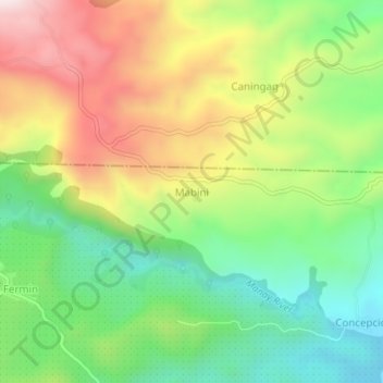
Name: Mabini topographic map, elevation, terrain.

Location: Mabini, Manay, Davao Oriental, Davao Region, 8202, Philippines (7.25167 126.46545 7.29167 126.50545)

Average elevation: 1,181 ft

Minimum elevation: 266 ft

Maximum elevation: 2,434 ft

Gear up for your next adventure:

🧭Compass with Lanyard - Easy‑carry compass for navigation
🕶️Glacier Sunglasses - Side shields to protect eyes from high-altitude snow glare
🎒Waterproof Dry Bags - Keep your electronics and maps dry inside your pack
🎒Day Hiking Backpack - Lightweight backpack perfect for day trips and outdoor adventures
🛡️Insect Repellent - Protection against bugs during outdoor activities

As an Amazon Associate, this site earns from qualifying purchases at no extra cost to you.