
Make a donation
Gear up for your next adventure:
As an Amazon Associate, this site earns from qualifying purchases at no extra cost to you.
Crooked Lake topographic map
Click on the map to display elevation.
Make a donation
Gear up for your next adventure:
As an Amazon Associate, this site earns from qualifying purchases at no extra cost to you.
About this map
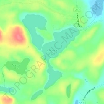
Name: Crooked Lake topographic map, elevation, terrain.
Location: Crooked Lake, Lake County, Minnesota, United States (47.59429 -91.08642 47.61385 -91.06411)
Average elevation: 1,749 ft
Minimum elevation: 1,660 ft
Maximum elevation: 1,890 ft
Lake County trails, hiking, mountain biking, running and outdoor activities
Make a donation
Gear up for your next adventure:
As an Amazon Associate, this site earns from qualifying purchases at no extra cost to you.
Other topographic maps
Click on a map to view its topography, its elevation and its terrain.
Boundary Waters Canoe Area Wilderness
United States > Minnesota > Lake County
Average elevation: 1,388 ft
Make a donation
Gear up for your next adventure:
As an Amazon Associate, this site earns from qualifying purchases at no extra cost to you.