
Thank you for supporting this site ❤️
Make a donation
Make a donation
Gear up for your next adventure:
As an Amazon Associate, this site earns from qualifying purchases at no extra cost to you.
Basècles topographic map
Click on the map to display elevation.
Thank you for supporting this site ❤️
Make a donation
Make a donation
Gear up for your next adventure:
As an Amazon Associate, this site earns from qualifying purchases at no extra cost to you.
About this map
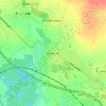
Name: Basècles topographic map, elevation, terrain.
Location: Basècles, Belœil, Aat, Henegouwen, Wallonië, 7971, België (50.50544 3.62835 50.54544 3.66835)
Average elevation: 164 ft
Minimum elevation: 82 ft
Maximum elevation: 276 ft
Thank you for supporting this site ❤️
Make a donation
Make a donation
Gear up for your next adventure:
As an Amazon Associate, this site earns from qualifying purchases at no extra cost to you.