
Thank you for supporting this site ❤️
Make a donation
Make a donation
Gear up for your next adventure:
As an Amazon Associate, this site earns from qualifying purchases at no extra cost to you.
Sibundoy topographic map
Click on the map to display elevation.
Thank you for supporting this site ❤️
Make a donation
Make a donation
Gear up for your next adventure:
As an Amazon Associate, this site earns from qualifying purchases at no extra cost to you.
About this map
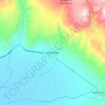
Name: Sibundoy topographic map, elevation, terrain.
Location: Sibundoy, Putumayo, 861020, Colombia (1.16541 -76.95600 1.24541 -76.87600)
Average elevation: 7,552 ft
Minimum elevation: 6,765 ft
Maximum elevation: 9,797 ft
Thank you for supporting this site ❤️
Make a donation
Make a donation
Gear up for your next adventure:
As an Amazon Associate, this site earns from qualifying purchases at no extra cost to you.