Geolocate

Saramarca topographic map

Click on the map to display elevation.

About this map

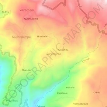
Name: Saramarca topographic map, elevation, terrain.

Location: Saramarca, Coracora, Parinacochas, Ayacucho, Perú (-15.08276 -73.78126 -15.04276 -73.74126)

Average elevation: 10,262 ft

Minimum elevation: 9,081 ft

Maximum elevation: 11,188 ft

Gear up for your next adventure:

🗺️Topographic Maps - Detailed topo maps for hiking, exploring and outdoor navigation
🎒Gear Packing Cubes - Organize your backpack efficiently
💧Water Filtration Bottles - Safely drink from streams and lakes while exploring
📦Dry Bags Set - Waterproof storage for electronics and clothes
🕶️GPS Smartphone Mount - Secure mount for phone navigation

As an Amazon Associate, this site earns from qualifying purchases at no extra cost to you.