
Thank you for supporting this site ❤️
Make a donation
Make a donation
Gear up for your next adventure:
As an Amazon Associate, this site earns from qualifying purchases at no extra cost to you.
Kabarak topographic map
Click on the map to display elevation.
Thank you for supporting this site ❤️
Make a donation
Make a donation
Gear up for your next adventure:
As an Amazon Associate, this site earns from qualifying purchases at no extra cost to you.
About this map
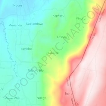
Name: Kabarak topographic map, elevation, terrain.
Location: Kabarak, Waseges ward, Subukia, Nakuru, Kenya (0.04495 36.23100 0.08495 36.27100)
Average elevation: 6,890 ft
Minimum elevation: 6,037 ft
Maximum elevation: 8,143 ft
Thank you for supporting this site ❤️
Make a donation
Make a donation
Gear up for your next adventure:
As an Amazon Associate, this site earns from qualifying purchases at no extra cost to you.