Geolocate

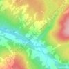
Armagh topographic map

Click on the map to display elevation.

About this map

Name: Armagh topographic map, elevation, terrain.

Location: Armagh, Bellechasse, Chaudière-Appalaches, Québec, G0R 1A0, Canada (46.66478 -70.67833 46.83507 -70.47506)

Average elevation: 1,070 ft

Minimum elevation: 400 ft

Maximum elevation: 1,621 ft

Other topographic maps

Click on a map to view its topography, its elevation and its terrain.

Lac des Cèdres

Canada > Québec > Bellechasse > Saint-Malachie

Average elevation: 1,027 ft

Hemison

Canada > Québec > Bellechasse > Saint-Malachie

Average elevation: 1,047 ft

Côte Saint-Gabriel

Canada > Québec > Bellechasse > Saint-Philémon

Average elevation: 1,391 ft

Mont du Midi

Canada > Québec > Bellechasse > Saint-Philémon

Average elevation: 2,490 ft

Gear up for your next adventure:

🧭Orienteering Set - Complete compass and map reading kit
🪶Camp Gear Gift Set - Perfect gift bundle for outdoor fans
🪶LED Camping Lantern - Bright lantern for camp lighting
📡Handheld GPS Device - Reliable handheld GPS for outdoor navigation
🛌Ultralight Sleeping Bags - Compact down bags for cold nights in the wilderness

As an Amazon Associate, this site earns from qualifying purchases at no extra cost to you.