Geolocate

Cascada Invertida topographic map

Click on the map to display elevation.

About this map

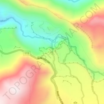
Name: Cascada Invertida topographic map, elevation, terrain.

Location: Cascada Invertida, San Clemente, Provincia de Talca, Chile (-35.95463 -70.57369 -35.95453 -70.57359)

Average elevation: 6,253 ft

Minimum elevation: 5,194 ft

Maximum elevation: 7,372 ft

Gear up for your next adventure:

🔥Fast-Boil Camping Stoves - Efficient cooking systems for quick trail meals
📚Navigation Handbooks - Master the art of reading topographic maps and using a compass
🏕️Tent Footprint - Protect your tent base from wear
🪶Compact Camp Shovel - Folding shovel for campsite tasks
🧥Men's Rain Shells - Premium waterproof and breathable jackets for mountain weather

As an Amazon Associate, this site earns from qualifying purchases at no extra cost to you.