Geolocate

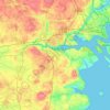
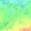
Gørding topographic map

Click on the map to display elevation.

About this map

Name: Gørding topographic map, elevation, terrain.

Location: Gørding, Esbjerg Municipality, Region of Southern Denmark, 6690, Denmark (55.45342 8.77995 55.49342 8.81995)

Average elevation: 69 ft

Minimum elevation: 30 ft

Maximum elevation: 128 ft

Other topographic maps

Click on a map to view its topography, its elevation and its terrain.
Funen

Denmark > Region of Southern Denmark

Average elevation: 62 ft

Funen

Denmark > Region of Southern Denmark

Average elevation: 62 ft

Funen

Denmark > Region of Southern Denmark

Average elevation: 62 ft

Fanø

Denmark > Region of Southern Denmark > Sønderho

Average elevation: 3 ft

Rømø

Denmark > Region of Southern Denmark

Average elevation: 0 ft

Funen

Denmark > Region of Southern Denmark

Average elevation: 62 ft

Skarø

Denmark > Region of Southern Denmark

Average elevation: 0 ft

Guldbjerg

Denmark > Region of Southern Denmark

Average elevation: 75 ft

Egholm

Denmark > Region of Southern Denmark

Average elevation: 0 ft

Funen

Denmark > Region of Southern Denmark

Average elevation: 62 ft

Ærø

Denmark > Region of Southern Denmark

Average elevation: 10 ft

Funen

Denmark > Region of Southern Denmark

Average elevation: 62 ft

Gear up for your next adventure:

🕶️GPS Smartphone Mount - Secure mount for phone navigation
🛠️Outdoor Gear Repair Kit - Essential tools to fix gear on the trail
🥾Hiking Shoes - Durable and comfortable shoes for trail hiking
⌚GPS Sports Watch - GPS watch for running, hiking and training
🧢Outdoor Hiking Hat - Sun protection hat for outdoor explorers

As an Amazon Associate, this site earns from qualifying purchases at no extra cost to you.