Geolocate

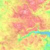
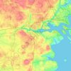
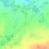
Gørding topographic map

Click on the map to display elevation.

About this map

Name: Gørding topographic map, elevation, terrain.

Location: Gørding, Esbjerg Municipality, Region of Southern Denmark, 6690, Denmark (55.45342 8.77995 55.49342 8.81995)

Average elevation: 69 ft

Minimum elevation: 30 ft

Maximum elevation: 128 ft

Other topographic maps

Click on a map to view its topography, its elevation and its terrain.
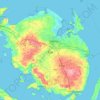
Funen

Denmark > Region of Southern Denmark

Average elevation: 62 ft

Funen

Denmark > Region of Southern Denmark

Average elevation: 62 ft

Funen

Denmark > Region of Southern Denmark

Average elevation: 62 ft

Fanø

Denmark > Region of Southern Denmark > Sønderho

Average elevation: 3 ft

Rømø

Denmark > Region of Southern Denmark

Average elevation: 0 ft

Funen

Denmark > Region of Southern Denmark

Average elevation: 62 ft

Skarø

Denmark > Region of Southern Denmark

Average elevation: 0 ft

Guldbjerg

Denmark > Region of Southern Denmark

Average elevation: 75 ft

Egholm

Denmark > Region of Southern Denmark

Average elevation: 0 ft

Funen

Denmark > Region of Southern Denmark

Average elevation: 62 ft

Ærø

Denmark > Region of Southern Denmark

Average elevation: 10 ft

Funen

Denmark > Region of Southern Denmark

Average elevation: 62 ft

Gear up for your next adventure:

🧥Men's Rain Shells - Premium waterproof and breathable jackets for mountain weather
📖Nature Tracking Books - Learn to track wildlife and terrain
⛺Backpacking Tents - Weight-optimized shelters for multi-day topographic surveys
🪶Fire Starter Kit - Reliable fire starter for survival and camping
👟Men's Trail Runners - Lightweight footwear for fast-paced exploration and light hiking

As an Amazon Associate, this site earns from qualifying purchases at no extra cost to you.