Geolocate

Marlin topographic map

Click on the map to display elevation.

About this map

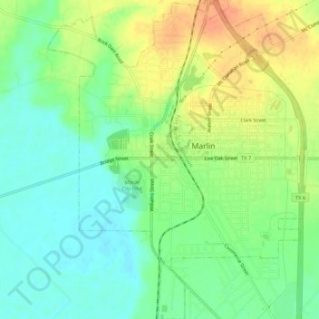
Name: Marlin topographic map, elevation, terrain.

Location: Marlin, Falls County, Texas, 76661, United States (31.28369 -96.91646 31.32849 -96.87439)

Average elevation: 390 ft

Minimum elevation: 325 ft

Maximum elevation: 466 ft

Falls County trails, hiking, mountain biking, running and outdoor activities

Other topographic maps

Click on a map to view its topography, its elevation and its terrain.

Satin

United States > Texas > Falls County

Average elevation: 377 ft

Gear up for your next adventure:

🌧️Backpack Rain Cover - Keep gear dry in wet weather
🧤Tactile Hiking Gloves - Keep hands warm while operating GPS and smartphone screens
🛡️Bear Spray Outdoor - Protection in bear country hikes
🥾Hiking Shoes - Durable and comfortable shoes for trail hiking
🧣Hiking Neck Gaiter - Multi‑use neck protection for outdoor weather

As an Amazon Associate, this site earns from qualifying purchases at no extra cost to you.