
Thank you for supporting this site ❤️
Make a donation
Make a donation
Gear up for your next adventure:
As an Amazon Associate, this site earns from qualifying purchases at no extra cost to you.
Sesma topographic map
Click on the map to display elevation.
Thank you for supporting this site ❤️
Make a donation
Make a donation
Gear up for your next adventure:
As an Amazon Associate, this site earns from qualifying purchases at no extra cost to you.
About this map
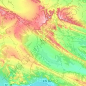
Name: Sesma topographic map, elevation, terrain.
Location: Sesma, Estellerria / Tierra Estella, Navarre, 31293, Spain (42.41762 -2.16216 42.52869 -2.01008)
Average elevation: 1,371 ft
Minimum elevation: 1,027 ft
Maximum elevation: 1,808 ft
Thank you for supporting this site ❤️
Make a donation
Make a donation
Gear up for your next adventure:
As an Amazon Associate, this site earns from qualifying purchases at no extra cost to you.