Geolocate

Kodada topographic map

Click on the map to display elevation.

About this map

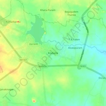
Name: Kodada topographic map, elevation, terrain.

Location: Kodada, Kodad mandal, Suryapet, Telangana, 508206, India (16.95478 79.93498 17.03478 80.01498)

Average elevation: 364 ft

Minimum elevation: 295 ft

Maximum elevation: 486 ft

Gear up for your next adventure:

🔋Solar Power Banks - Keep your GPS and phone charged in remote wilderness areas
🧤Hiking Gloves - Protective gloves for rugged trails
🧯Emergency Survival Kit - All‑in‑one survival essentials for the backcountry
🍳Camping Cook Set - Complete cookware for outdoor meals
👖Convertible Hiking Pants - Versatile zip-off pants for changing altitudes and temperatures

As an Amazon Associate, this site earns from qualifying purchases at no extra cost to you.