
Cuernavaca topographic map
Click on the map to display elevation.
Cuernavaca
The city is located in a tropical region, but its temperature is fairly constant at 21–26 °C (70–79 °F). It is located on the southern slope of the Sierra de Chichinautzin mountains. In the morning, warm air flows up the mountains from the valley below and in the late afternoon, cooler air flows down from the higher elevations. One ubiquitous flowering plant in the city is the bougainvillea.
About this map
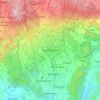
Name: Cuernavaca topographic map, elevation, terrain.
Location: Cuernavaca, Morelos, 62000, Mexico (18.76183 -99.39423 19.08183 -99.07423)
Average elevation: 5,978 ft
Minimum elevation: 3,166 ft
Maximum elevation: 12,070 ft