Geolocate

Manitowoc topographic map

Click on the map to display elevation.

About this map

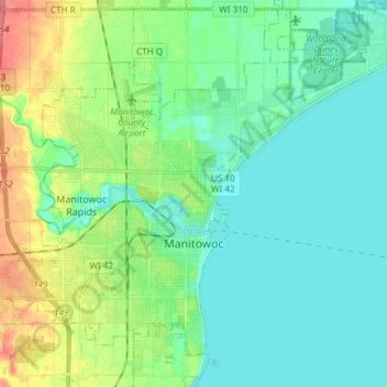
Name: Manitowoc topographic map, elevation, terrain.

Location: Manitowoc, Manitowoc County, Wisconsin, United States (44.04881 -87.76151 44.15601 -87.62003)

Average elevation: 627 ft

Minimum elevation: 564 ft

Maximum elevation: 797 ft

Manitowoc County trails, hiking, mountain biking, running and outdoor activities

Other topographic maps

Click on a map to view its topography, its elevation and its terrain.

Cato

United States > Wisconsin > Manitowoc County

Average elevation: 856 ft

Woods

United States > Wisconsin > Manitowoc County > Manitowoc

Average elevation: 686 ft

Gear up for your next adventure:

🥾Hiking Shoes - Durable and comfortable shoes for trail hiking
🦶Carbon Trekking Poles - Reduce knee impact on steep descents with ultra-light poles
🏕️Tent Footprint - Protect your tent base from wear
🧤Hiking Gloves - Protective gloves for rugged trails
📚Navigation Handbooks - Master the art of reading topographic maps and using a compass

As an Amazon Associate, this site earns from qualifying purchases at no extra cost to you.