
Thank you for supporting this site ❤️
Make a donation
Make a donation
Gear up for your next adventure:
As an Amazon Associate, this site earns from qualifying purchases at no extra cost to you.
Bhrajam topographic map
Click on the map to display elevation.
Thank you for supporting this site ❤️
Make a donation
Make a donation
Gear up for your next adventure:
As an Amazon Associate, this site earns from qualifying purchases at no extra cost to you.
About this map
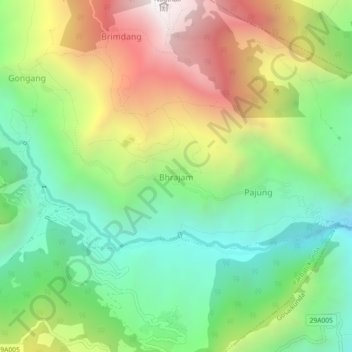
Name: Bhrajam topographic map, elevation, terrain.
Location: Bhrajam, Parbati Kunda, Rasuwa, Bagmati Province, Nepal (28.16774 85.29696 28.20774 85.33696)
Average elevation: 7,182 ft
Minimum elevation: 4,915 ft
Maximum elevation: 10,650 ft
Thank you for supporting this site ❤️
Make a donation
Make a donation
Gear up for your next adventure:
As an Amazon Associate, this site earns from qualifying purchases at no extra cost to you.
Other topographic maps
Click on a map to view its topography, its elevation and its terrain.