
Maralal topographic map
Interactive map
Click on the map to display elevation.
About this map
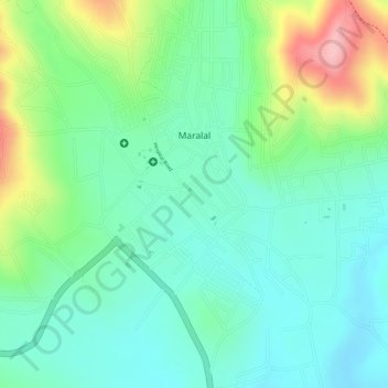
Name: Maralal topographic map, elevation, terrain.
Location: Maralal, Samburu, Kenya (1.08399 36.68706 1.10779 36.70876)
Average elevation: 6,417 ft
Minimum elevation: 6,224 ft
Maximum elevation: 6,831 ft
Other topographic maps
Click on a map to view its topography, its elevation and its terrain.