
Shell Point topographic map
Click on the map to display elevation.
About this map
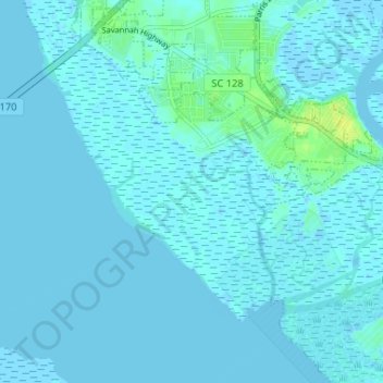
Name: Shell Point topographic map, elevation, terrain.
Location: Shell Point, Beaufort County, South Carolina, United States (32.34695 -80.78193 32.39736 -80.71683)
Average elevation: 7 ft
Minimum elevation: -10 ft
Maximum elevation: 52 ft
Beaufort County trails, hiking, mountain biking, running and outdoor activities
Other topographic maps
Click on a map to view its topography, its elevation and its terrain.
Pritchardville
United States > South Carolina > Beaufort County > Town of Bluffton
Average elevation: 26 ft
Sea Pines
United States > South Carolina > Beaufort County > Hilton Head Island
Average elevation: 13 ft
Coligny
United States > South Carolina > Beaufort County > Hilton Head Island
Average elevation: 10 ft
Green Pond
United States > South Carolina > Beaufort County > Port Royal > Green Pond
Average elevation: 13 ft
Port Royal Landing
United States > South Carolina > Beaufort County > Port Royal > Port Royal Landing
Average elevation: 16 ft
Port Royal Sound
United States > South Carolina > Beaufort County > Hilton Head Island
Average elevation: 0 ft
Pocosin
United States > South Carolina > Beaufort County > Hilton Head Island
Average elevation: 13 ft