
Thank you for supporting this site ❤️
Make a donation
Make a donation
Gear up for your next adventure:
As an Amazon Associate, this site earns from qualifying purchases at no extra cost to you.
Meranges topographic map
Click on the map to display elevation.
Thank you for supporting this site ❤️
Make a donation
Make a donation
Gear up for your next adventure:
As an Amazon Associate, this site earns from qualifying purchases at no extra cost to you.
About this map
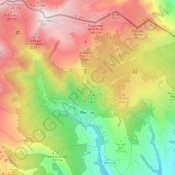
Name: Meranges topographic map, elevation, terrain.
Location: Meranges, Cerdanya, Girona, Catalonia, Spain (42.41862 1.72427 42.49539 1.81339)
Average elevation: 6,781 ft
Minimum elevation: 4,091 ft
Maximum elevation: 9,537 ft
Thank you for supporting this site ❤️
Make a donation
Make a donation
Gear up for your next adventure:
As an Amazon Associate, this site earns from qualifying purchases at no extra cost to you.