Geolocate

Gokyo topographic map

Click on the map to display elevation.

Gokyo

Located at an elevation of 4,750 m (15,584 ft), the village is one of the highest settlements in Nepal and in the world. Almost all the buildings are guest houses for trekkers. The people who live in the village leave during the winter and move to other (lower) villages, or Kathmandu.

Wikipedia (CC-BY-SA 3.0)

About this map

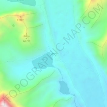
Name: Gokyo topographic map, elevation, terrain.

Location: Gokyo, Khumbupasanglahmu-04, Khumbupasanglahmu, Solukhumbu, Koshi Province, Nepal (27.93409 86.67459 27.97409 86.71459)

Average elevation: 16,138 ft

Minimum elevation: 15,341 ft

Maximum elevation: 19,442 ft

Other topographic maps

Click on a map to view its topography, its elevation and its terrain.

Sotang

Nepal > Koshi Province > Solukhumbu

Average elevation: 7,129 ft

West Ridge

Nepal > Koshi Province > Solukhumbu

Average elevation: 23,081 ft

Likhupike

Nepal > Koshi Province > Solukhumbu

Average elevation: 9,039 ft

Khumbupasanglahmu-05

Nepal > Koshi Province > Solukhumbu

Average elevation: 17,165 ft

Gear up for your next adventure:

Backpacking Tent - Lightweight and durable tent for multi‑day hikes
🎒Hydration Pack - Hands‑free water reservoir for long hikes
🧭Orienteering Set - Complete compass and map reading kit
Backpacking Tents - Weight-optimized shelters for multi-day topographic surveys
⛑️Personal Locator Beacon - Safety beacon for emergencies

As an Amazon Associate, this site earns from qualifying purchases at no extra cost to you.