Geolocate

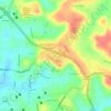
Mukka topographic map

Click on the map to display elevation.

About this map

Name: Mukka topographic map, elevation, terrain.

Location: Mukka, Mangaluru taluk, Dakshina Kannada, Karnataka, 575021, India (13.00244 74.77000 13.04244 74.81000)

Average elevation: 23 ft

Minimum elevation: -10 ft

Maximum elevation: 112 ft

Other topographic maps

Click on a map to view its topography, its elevation and its terrain.
Jeppu Park

India > Karnataka > Mangaluru taluk > Mangaluru

Average elevation: 43 ft

Kadri Park

India > Karnataka > Mangaluru taluk > Mangaluru

Average elevation: 144 ft

Jeppu Park

India > Karnataka > Mangaluru taluk > Mangaluru

Average elevation: 43 ft

Gear up for your next adventure:

🧦Hiking Socks - Comfortable socks to prevent blisters on long hikes
⛑️Personal Locator Beacon - Safety beacon for emergencies
📖Nature Tracking Books - Learn to track wildlife and terrain
🎁Geography Themed Gifts - Unique gift ideas for map lovers and geography enthusiasts
🔌Solar Panel Charger - Charge gear sustainably outdoors

As an Amazon Associate, this site earns from qualifying purchases at no extra cost to you.