
Make a donation
Gear up for your next adventure:
As an Amazon Associate, this site earns from qualifying purchases at no extra cost to you.
Chester topographic map
Click on the map to display elevation.
Make a donation
Gear up for your next adventure:
As an Amazon Associate, this site earns from qualifying purchases at no extra cost to you.
Chester
Lake Elwell, 15 miles (24 km) southwest of Chester, offer opportunities for boating, skiing, camping, picnicking, and both freshwater fishing and ice fishing. Fishing and floating are also available on the Marias River downstream from Tiber Dam. The Sweet Grass Hills to the north are the highest elevation peaks east of Glacier Park within 30 miles (48 km) of Highway 2. Hunting for deer, antelope, game birds, and elk is popular in the fall.
Make a donation
Gear up for your next adventure:
As an Amazon Associate, this site earns from qualifying purchases at no extra cost to you.
About this map
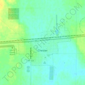
Name: Chester topographic map, elevation, terrain.
Location: Chester, Liberty County, Montana, 59522, United States (48.50549 -110.97888 48.52014 -110.95384)
Average elevation: 3,146 ft
Minimum elevation: 3,117 ft
Maximum elevation: 3,189 ft
Liberty County trails, hiking, mountain biking, running and outdoor activities
Make a donation
Gear up for your next adventure:
As an Amazon Associate, this site earns from qualifying purchases at no extra cost to you.