
Make a donation
Gear up for your next adventure:
As an Amazon Associate, this site earns from qualifying purchases at no extra cost to you.
Park Rosenhöhe topographic map
Click on the map to display elevation.
Make a donation
Gear up for your next adventure:
As an Amazon Associate, this site earns from qualifying purchases at no extra cost to you.
Park Rosenhöhe
Der Park Rosenhöhe ist ein historischer Park auf einem Hügel im Osten Darmstadts. Zu seinen Besonderheiten gehören ein Rosarium mit Rosendom auf der Kuppe des Hügels sowie die Mausoleen und Grabstätten des hessischen Fürstenhauses. Am Rande des Parks befinden sich auch die Gebäude der Neuen Künstlerkolonie Rosenhöhe.
Make a donation
Gear up for your next adventure:
As an Amazon Associate, this site earns from qualifying purchases at no extra cost to you.
About this map
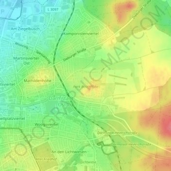
Name: Park Rosenhöhe topographic map, elevation, terrain.
Location: Park Rosenhöhe, Darmstadt-Ost, Darmstadt, Hessen, Deutschland (49.87412 8.67304 49.87791 8.68347)
Average elevation: 558 ft
Minimum elevation: 449 ft
Maximum elevation: 682 ft
Make a donation
Gear up for your next adventure:
As an Amazon Associate, this site earns from qualifying purchases at no extra cost to you.
Other topographic maps
Click on a map to view its topography, its elevation and its terrain.
Make a donation
Gear up for your next adventure:
As an Amazon Associate, this site earns from qualifying purchases at no extra cost to you.