Geolocate

Heidelberg topographic map

Click on the map to display elevation.

About this map

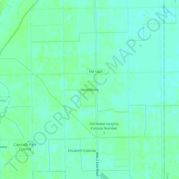
Name: Heidelberg topographic map, elevation, terrain.

Location: Heidelberg, Hidalgo County, Texas, United States (26.17702 -97.90028 26.21702 -97.86028)

Average elevation: 62 ft

Minimum elevation: 49 ft

Maximum elevation: 72 ft

Hidalgo County trails, hiking, mountain biking, running and outdoor activities

Other topographic maps

Click on a map to view its topography, its elevation and its terrain.

Palmview

United States > Texas > Hidalgo County

Average elevation: 141 ft

Edcouch

United States > Texas > Hidalgo County

Average elevation: 66 ft

Palmview

United States > Texas > Hidalgo County

Average elevation: 141 ft

Peñitas

United States > Texas > Hidalgo County

Average elevation: 174 ft

La Joya

United States > Texas > Hidalgo County

Average elevation: 157 ft

La Villa

United States > Texas > Hidalgo County

Average elevation: 62 ft

Granjeno

United States > Texas > Hidalgo County

Average elevation: 105 ft

Gear up for your next adventure:

📷Action Cameras - Rugged cameras to document your journeys across rugged terrain
👟Trail Running Shoes - Lightweight shoes for trail runners
📡Handheld GPS Device - Reliable handheld GPS for outdoor navigation
🪵Folding Camp Saw - Compact saw for wood and campsite work
🥩Freeze-Dried Meals - Nutritious and lightweight food for remote expeditions

As an Amazon Associate, this site earns from qualifying purchases at no extra cost to you.