Geolocate

Semirara topographic map

Click on the map to display elevation.

About this map

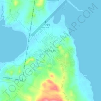
Name: Semirara topographic map, elevation, terrain.

Location: Semirara, Caluya, Antique, Western Visayas, Philippines (12.04454 121.37147 12.08454 121.41147)

Average elevation: 56 ft

Minimum elevation: 0 ft

Maximum elevation: 325 ft

Other topographic maps

Click on a map to view its topography, its elevation and its terrain.

Semirara Island

Philippines > Antique > Caluya

Average elevation: 20 ft

Gear up for your next adventure:

🎒Gear Packing Cubes - Organize your backpack efficiently
🌲Outdoor Survival Books - Best books on survival skills
🏕️Family Camping Gear - Essentials for group camping trips
🏫Relief Map Kits - Hands-on tools for teaching landforms and elevation
🪄Magnetic Compass - Accurate compass for navigation

As an Amazon Associate, this site earns from qualifying purchases at no extra cost to you.