
Sidi Khelifa topographic map
Interactive map
Click on the map to display elevation.
About this map
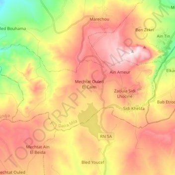
Name: Sidi Khelifa topographic map, elevation, terrain.
Location: Sidi Khelifa, Daïra Mila, Mila, Algérie (36.33498 6.17954 36.39245 6.32347)
Average elevation: 2,795 ft
Minimum elevation: 1,270 ft
Maximum elevation: 4,111 ft
Other topographic maps
Click on a map to view its topography, its elevation and its terrain.
Aïn Nechma
Algérie > Mila > Daïra Mila
Aïn Nechma, Daïra Mila, Mila, 43000, Algérie
Average elevation: 1,522 ft