

Wauregan topographic map
Click on the map to display elevation.
Wauregan
The village is centered on the former site of the mill on the east bank of the Quinebaug River, near where modern Route 205 crosses the river. The village extends eastward from the river up a gently rising slope towards Route 12 located at the crest of a ridge. The mill workers' houses are located along Walnut and Chestnut streets just east of the mill site, while the supervisor's houses and the company store are located further east (and further up in elevation). The mill owners' houses and the church are even further up and east. The historic district covers an area of about 90 acres (360,000 m2), roughly bounded on the east by Grove Street, Fountain Street, Route 12, Route 205, and South Chestnut Street; on the south by Third Street; on the west by South Walnut Street, a westward extension of First Street, and the Quinebaug River; and on the north by the extension of the east-west portion of North Chestnut Street. The boundaries of the historic district exclude a large tract of open land to the north that the Wauregan company once owned. The district includes 114 buildings and structures.
About this map
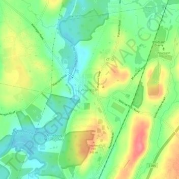
Name: Wauregan topographic map, elevation, terrain.
Average elevation: 223 ft
Minimum elevation: 118 ft
Maximum elevation: 377 ft