Geolocate

Mais topographic map

Click on the map to display elevation.

About this map

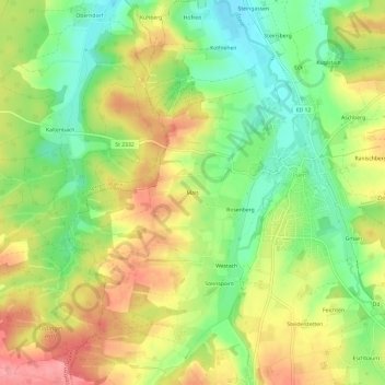
Name: Mais topographic map, elevation, terrain.

Location: Mais, Isen, Landkreis Erding, Bayern, 84424, Deutschland (48.19020 12.02040 48.23020 12.06040)

Average elevation: 1,749 ft

Minimum elevation: 1,591 ft

Maximum elevation: 1,919 ft

Gear up for your next adventure:

🪶Trail Camera - Capture wildlife on your hikes
❄️Traction Cleats - Prevent slips on icy trails during winter hikes
🥾Men's Hiking Boots - Durable, waterproof footwear for rugged terrain and steep inclines
🧣Hiking Neck Gaiter - Multi‑use neck protection for outdoor weather
🪶Compact Camp Shovel - Folding shovel for campsite tasks

As an Amazon Associate, this site earns from qualifying purchases at no extra cost to you.