
Meggett topographic map
Click on the map to display elevation.
About this map
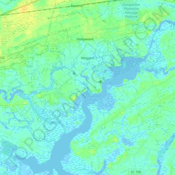
Name: Meggett topographic map, elevation, terrain.
Location: Meggett, Charleston County, South Carolina, United States (32.64759 -80.35120 32.73680 -80.17056)
Average elevation: 16 ft
Minimum elevation: -10 ft
Maximum elevation: 66 ft
Charleston County trails, hiking, mountain biking, running and outdoor activities
Other topographic maps
Click on a map to view its topography, its elevation and its terrain.
Hobcaw Point
United States > South Carolina > Charleston County > Mount Pleasant
Average elevation: 13 ft
Saint Andrews Heights
United States > South Carolina > Charleston County > Charleston
Average elevation: 16 ft
Pinewood Vista
United States > South Carolina > Charleston County > North Charleston
Average elevation: 30 ft
Palmetto Fort
United States > South Carolina > Charleston County > Mount Pleasant
Average elevation: 13 ft
Fenwick Crossroads
United States > South Carolina > Charleston County > Charleston
Average elevation: 16 ft
Jamestown Estates
United States > South Carolina > Charleston County > James Island
Average elevation: 13 ft
Brook Green Meadow
United States > South Carolina > Charleston County > Mount Pleasant
Average elevation: 13 ft
Remleys Point
United States > South Carolina > Charleston County > Mount Pleasant
Average elevation: 13 ft
Camp Saint Christopher
United States > South Carolina > Charleston County > Seabrook Island
Average elevation: 7 ft
North Charleston Wannamaker County Park
United States > South Carolina > Charleston County > North Charleston
Average elevation: 26 ft
Forest Park
United States > South Carolina > Charleston County > Charleston > Maryville
Average elevation: 16 ft
Forest Trail
United States > South Carolina > Charleston County > Isle of Palms
Average elevation: 3 ft
Liberty Hill
United States > South Carolina > Charleston County > North Charleston
Average elevation: 23 ft
Wando Estates
United States > South Carolina > Charleston County > Mount Pleasant
Average elevation: 16 ft
Moss Park
United States > South Carolina > Charleston County > Mount Pleasant
Average elevation: 13 ft
Saint Andrews Heights
United States > South Carolina > Charleston County > Charleston
Average elevation: 16 ft
Ashley Junction
United States > South Carolina > Charleston County > North Charleston
Average elevation: 23 ft
Camp Saint Christopher
United States > South Carolina > Charleston County > Seabrook Island
Average elevation: 7 ft
Northwood Estates
United States > South Carolina > Charleston County > North Charleston > Northwood Estates
Average elevation: 26 ft
North Charleston
United States > South Carolina > Charleston County > North Charleston
Average elevation: 16 ft
Country Club Estates
United States > South Carolina > Charleston County > Charleston
Average elevation: 10 ft