
Aserrí topographic map
Click on the map to display elevation.
About this map
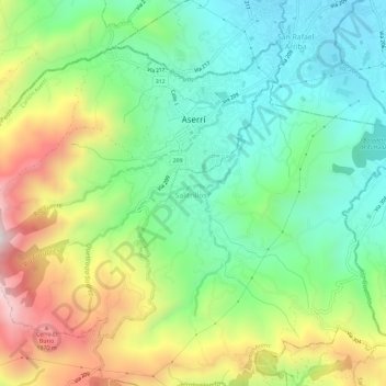
Name: Aserrí topographic map, elevation, terrain.
Location: Aserrí, Cantón Aserrí, San Jose Province, 10601, Costa Rica (9.83160 -84.13664 9.87575 -84.07897)
Average elevation: 4,918 ft
Minimum elevation: 3,806 ft
Maximum elevation: 6,890 ft