
Make a donation
Gear up for your next adventure:
As an Amazon Associate, this site earns from qualifying purchases at no extra cost to you.
Hackenberg topographic map
Click on the map to display elevation.
Make a donation
Gear up for your next adventure:
As an Amazon Associate, this site earns from qualifying purchases at no extra cost to you.
Hackenberg
1443 wird Hackenberg in einer Liste über die Einkünfte und Rechte des Kölner Apostelstiftes mit der Ortsbezeichnung Hackenberghe erstmals genannt. Die Karte Topographia Ducatus Montani aus dem Jahre 1715 zeigt zwei Höfe und bezeichnet diese mit Hackenberg. Am Weg zwischen den beiden Häusern Hackenberg 1 und 2 steht ein altes Wegekreuz, dass aus dem Jahr 1782 stammt. Es ist ein gelistetes Baudenkmal (Nr. 36) der Stadt Wipperfürth.
Make a donation
Gear up for your next adventure:
As an Amazon Associate, this site earns from qualifying purchases at no extra cost to you.
About this map
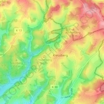
Name: Hackenberg topographic map, elevation, terrain.
Average elevation: 1,158 ft
Minimum elevation: 981 ft
Maximum elevation: 1,342 ft
Make a donation
Gear up for your next adventure:
As an Amazon Associate, this site earns from qualifying purchases at no extra cost to you.